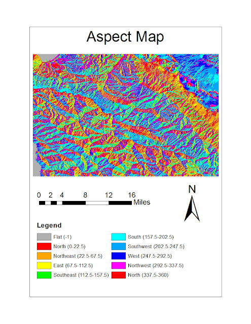
This area is south of Monterrey Bay, directly south of the city of Salinas. It includes Toro Park, Laguna Seca Recreation Area, and the Carmel Valley. This area also includes part of Garrapata State Park; parts of the cities of Monterrey, Carmel, and Gonzales; and sections of the 101 and 1 Freeways. The area is about 21 miles North-South by about 26 miles East-West as very roughly approximated on GoogleMaps. The land contained by this area is utilized for a myriad of uses, including urban and suburban development, a military housing complex, a presidio, recreation areas, golf courses, parks, agriculture, an airport, and roads. The top left corner includes an area of Monterrey Bay and the bottom left corner includes a piece of the Pacific Ocean. The topography varies greatly across the area with hills and valleys.
The approximate location of this area is shown on this GoogleMap image. The four points represent the four corners of the area's extent given by the DEM model.
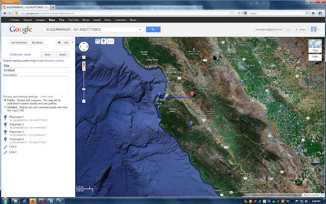
The extent information in decimal degrees of this area is described in the DEM model as:
Top: 36.622499999247
Left: -121.91444444567, Right: - 121.450277778972
Bottom: 36.3163888881153
This area is defined by the Geographic Coordinate System North American 1983.
3D Image


No comments:
Post a Comment