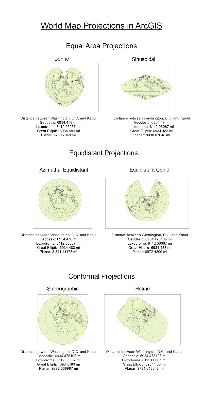
The variety of map projections and range of layouts and types within each projection category provide several opportunities for how to present geographic information. For example, both the Bonne and Sinusoidal projections are equal are projections, meaning that they preserve the relative areas of continents and oceans on their maps. Even so, the two projections appear very different from one another so could be preferred for different presentations of information or other uses. The sheer number of available map projections mean that users have several options for selecting a projection that best fits a specific use.
This same extent of options, however, can make choosing and understanding map projections difficult. Certain map projections are surely better suited for particular purposes, but it can be hard to decide which map projection is most accurate or should be widely used. The contortion of the graticule on some projections could make locating a point or determining distance especially difficult.
In addition to complicating decisions about map usages, map projections can make thinking about the real world confusing. Knowing which distances are accurate can be difficult, especially with limited knowledge of map projections or measurement types. It is easier to understand why the Planar measurement changes projection to projection, but difficult to know when the Planar measurement is an accurate representation of distance. Because the Geodesic and Great Elliptic measurements remained constant throughout the six projections and similar to one another, it seems reasonable to assume that the distance between Washington, D.C. and Kabul is indeed about 6,934.48 miles. The Loxodromic measurement also remained constant across all the projections though, but gave a distance of 8,112.06 miles between the two cities. The difference between the Loxodromic and Geodesic/Great Elliptic measurements is so great that it definitely can cause confusion about map projection measurements and possibly even uncertainty about the actual distance separating Washington, D.C. and Kabul.
Because of these potential pitfalls, users must be especially when choosing and reading world maps. Both map makers and users should be aware of the projection type, preserved properties, and contorted properties in order to read the map correctly. Only being informed of the variety and staying alert to potential challenges, can we most effectively and truthfully convey and understand geographic information on map projections. Once these pitfalls are understood and users cautioned, however, the range of available map projections can be utilized to most accurately and easily express geography.
No comments:
Post a Comment